Culture
The California Forest Observatory's is turning data info fire maps
These granular insights could save lives and help locals better understand upcoming hazards.
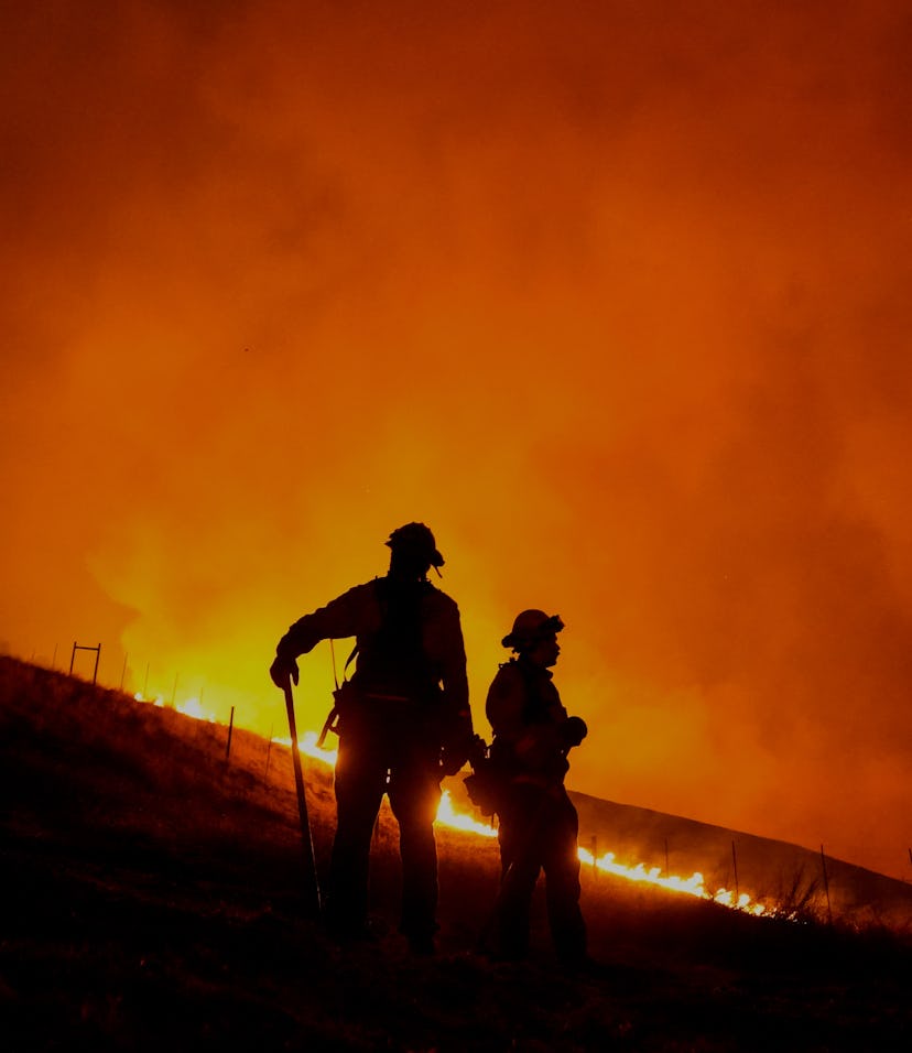
Hundreds of thousands of Californians live within close proximity of wildfires and although social media networks like Facebook continue to be epicenters of misinformation regarding these devastating waves, some organizations are trying to provide a little respite — and foresight — with more granular, verifiable, knowledge-based solutions.
To better equip locals as well as environmental scientists with megafire information, the California Forest Observatory (CFO) has launched an interactive, data-based monitoring system. The premise of the entire project is to give updates on affected areas with the help of satellite imagery and Light Detection and Ranging (LIDAR) scans.
“Using high-resolution satellite imagery from Planet, airborne laser scanning and artificial intelligence, we created a system to provide current data at scale of the individual tree,” the CFO explains. “We aim to support the development of data-driven land management to decrease wildfire hazard and increase forest resilience statewide.”
How does it work? — CFO's layout is incredibly straightforward and wastes no time in making information readily available, and this is key for understanding wildfire behavior and how it affects weather, vegetation fuels, and topography. If you want to see how CFO information translates on the website, you need to use the Layers tab which then activates different datasets. You can get an idea about wind speed, where fire hot spots are, if there are canopy covers, the height of different canopies, and more.
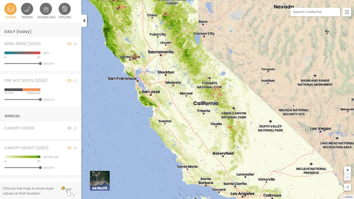
With the help of the Pyregence consortium, CFO also gives you an idea about wildfire exposure forecasts. "Exposure is the wildfire hazard that a specific location like a community or forested watershed might experience," CFO explains. This could potentially save lives by giving people data-based forecasts related to wildfire hazards and suggestions related to evacuation. You can check it out in the Trends tab on CFO's website.
Free for all — CFO's map and the detailed information present in this set is open for anyone who seeks to learn more about California wildfires. "Using the Download tab, you can select multiple data layers for the current year and subset them by county, community, or watershed," CFO explains.
The map is not only beneficial for scientists and environmental experts who are looking to understand the spread and effect of these fires — including how the California state's temperature is rising — but also locals within devastated areas who could benefit from regularly updated information.
